






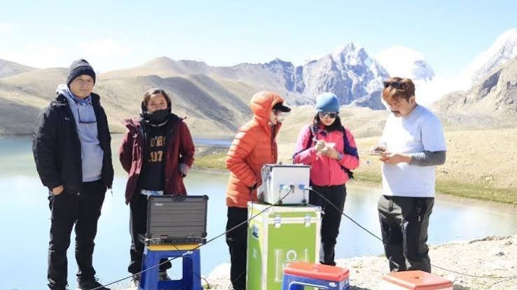
Glacial lake mapping is gaining importance in Sikkim as scientists and disaster managers improve systems to identify dangerous high-altitude lakes and assess the threat of Glacial Lake Outburst Floods (GLOFs).
The effort received a technology boost after C-DAC handed an indigenous glacial lake monitoring suite to Sikkim’s Department of Science and Technology in June 2026. The system supports autonomous lake profiling and risk assessment.
Glacial lake mapping expands risk assessment
The latest initiative gives Sikkim a stronger scientific tool to study lakes that can pose a threat downstream. According to the Press Information Bureau, the state has about 320 glacial lakes, with 14 identified as high-risk.
The suite was handed over at the Sikkim State Council of Science and Technology in Gangtok on June 25. A workshop brought scientists, engineers and policymakers together to discuss autonomous surveys, IoT-based warning systems and high-altitude bathymetry.
The state team also received training in the NiyanthriQ and AGLP software platforms, helping officials carry out field deployments independently. The approach is especially important in remote northern and eastern parts of the state, where difficult terrain can make frequent conventional surveys costly, slow and challenging for field teams.
Sikkim is now the first Indian state to independently operate an indigenous end-to-end system for glacial lake profiling and risk assessment, according to the government.
Why GLOF risk remains a concern
A GLOF occurs when water stored in a glacial lake is suddenly released, often after a natural dam fails or is overtopped. Such floods can move rapidly through mountain valleys and damage downstream settlements and infrastructure.
Sikkim has experienced the consequences of such hazards. The October 2023 outburst involving South Lhonak Lake caused severe flooding in the Teesta basin and highlighted the need for better monitoring and early warning.
Recent studies also point to changing lake conditions in the Sikkim Himalaya. A 2024 study updated the inventory of larger glacial lakes and identified one as very high risk and eight as high risk. Modelling also showed that some outburst scenarios could produce very large peak discharges.
Glacial lake mapping uses modern tools
The new system aims to make glacial lake mapping more detailed and operational. High-altitude bathymetry can reveal lake depth and underwater features, while autonomous surveys can improve data collection in difficult terrain.
Moreover, continuous monitoring can help identify changes in water levels and lake conditions. The government has also highlighted IoT-based early warning systems.
Earlier research shows why such monitoring matters. A study published in 2022 found that 203 new lakes developed in North Sikkim between 2000 and 2018. Of these, 82 appeared during 2011–2018. Researchers identified 36 of the most hazardous lakes and selected 10 as posing the greatest GLOF threat.
Building a stronger early warning system
Technology alone cannot eliminate GLOF risk. However, reliable data can support faster decisions, hazard modelling and targeted field inspections.
C-DAC has previously developed a GLOF early warning system for Sikkim, including water-level sensors at Shakho Chho in North Sikkim. The system transmits near-real-time data through the INSAT satellite network to a control centre in Gangtok and can simulate flood scenarios and arrival times.
The new profiling capability can complement these measures by improving information about individual lakes. Consequently, authorities can identify sites needing closer observation, warning infrastructure or further studies.
Glacial lake mapping supports preparedness
Sikkim’s latest technology transfer reflects a wider shift toward locally operated disaster monitoring in the Himalaya. Instead of relying only on periodic surveys, the state can increasingly combine field measurements, digital tools and remote observations.
At the same time, GLOF risk is complex. Lake size alone does not determine danger. Moraine-dam stability, possible triggers, downstream terrain and exposure also matter.
Therefore, glacial lake mapping should be treated as part of a wider risk-management system. Continued field studies, early warnings and community preparedness will remain important as glaciers and high-altitude lakes change.
For Sikkim, the immediate priority is to turn improved scientific information into practical preparedness. The new indigenous system gives state authorities another tool to monitor vulnerable lakes and strengthen their response to a potentially fast-moving Himalayan hazard.