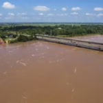







Assam has reportedly experienced a striking contrast in monsoon rainfall patterns, with overall state rainfall falling by 28% below normal levels while isolated pockets in Upper Assam recorded a concentrated spike of 490% above normal. The sharp variation highlights the uneven nature of rainfall distribution across the state.
The reported figures show why state-level rainfall averages may not fully capture local weather extremes. Moreover, a significant deficit across Assam can occur alongside exceptionally heavy rainfall in specific areas, creating both water shortages and flood risks within the same season.
The unusual distribution could complicate disaster planning, agriculture, and water management. However, the available information does not identify the exact locations of the 490% increase or the specific period used to calculate the reported figures.
Assam Reviews Flood Mapping After Worst-Hit Districts
Assam Records Sharp Rainfall Contrast
The reported rainfall data presents two very different pictures of Assam’s monsoon season.
Statewide rainfall has reportedly remained 28% below normal, while isolated areas in Upper Assam experienced rainfall levels 490% above normal. Furthermore, the contrast demonstrates how regional weather patterns can differ substantially within a single state.
Such variations can make statewide averages difficult to interpret.
However, the figures require comparison with official rainfall records for the relevant period and locations.
Upper Assam Sees Localised Surge
Parts of Upper Assam reportedly recorded an extraordinary rainfall increase.
A 490% deviation above normal represents a major departure from the area’s typical rainfall baseline. Additionally, concentrated rainfall over a short period can create significant pressure on drainage systems, rivers, roads, and low-lying communities.
The impact can become particularly serious when heavy rain falls across already saturated catchments.
However, the available information does not identify the exact districts responsible for the reported spike.
Statewide Deficit Masks Local Extremes
The 28% statewide rainfall deficit creates an important contrast with the Upper Assam surge.
A state-level average combines rainfall measurements from multiple locations. Therefore, exceptionally wet pockets can exist alongside areas that receive considerably less rainfall than normal.
This pattern can make broad rainfall statistics appear less dramatic than local conditions.
Moreover, disaster response agencies need district-level and even sub-district-level information to understand immediate risks.
Heavy Rainfall Can Trigger Flood Risks
Concentrated rainfall can quickly increase surface runoff.
When rainfall exceeds the capacity of soil, drainage channels, and rivers, water can accumulate rapidly. Furthermore, intense precipitation in upstream areas can increase downstream river levels even when nearby locations receive less rain.
These conditions can create localised flood risks.
However, rainfall alone does not determine the severity of flooding.
Agriculture Faces Mixed Conditions
The uneven rainfall pattern can create different challenges for farmers across Assam.
Areas experiencing rainfall deficits may face moisture shortages and reduced water availability. Meanwhile, locations receiving excessive rainfall can encounter waterlogging, crop damage, soil erosion, and delayed agricultural operations.
Moreover, farmers in different districts may therefore require very different responses during the same monsoon season.
However, the impact on specific crops has not been provided.
Water Management Becomes More Complex
Rainfall variation can complicate reservoir, irrigation, and groundwater planning.
Authorities need to account for both areas experiencing shortages and locations facing excess water. Additionally, sudden rainfall spikes can require rapid adjustments in drainage and flood-management operations.
Better local forecasting can help authorities respond more effectively.
However, no specific changes to Assam’s water-management strategy have been announced.
Local Forecasting Gains Importance
Statewide rainfall statistics cannot fully explain highly concentrated weather events.
District-level forecasts, rainfall monitoring stations, radar observations, and satellite data can provide more detailed information. Furthermore, real-time monitoring can help authorities identify areas where rainfall is becoming unusually intense.
This information can support earlier warnings and emergency preparations.
However, the availability and coverage of these systems vary across locations.
Rainfall Distribution Matters
The reported figures demonstrate that the amount of rainfall matters less than its distribution when assessing immediate risks.
A rainfall deficit across a large area can coexist with extreme precipitation in a smaller region. Moreover, the timing, duration, and intensity of rainfall can determine whether an area experiences drought-like conditions, waterlogging, or flooding.
Authorities therefore need to examine multiple indicators.
However, the reported 490% figure alone does not establish the total volume of rainfall received.
Infrastructure Faces Uneven Pressure
Roads, bridges, drainage networks, and embankments can experience different levels of stress depending on local rainfall.
Areas affected by the concentrated Upper Assam rainfall may face greater pressure on drainage and transportation infrastructure. At the same time, areas with rainfall deficits may face different infrastructure and water-supply challenges.
This uneven pressure complicates statewide planning.
However, no specific infrastructure damage has been directly linked to the reported rainfall spike in the available information.
Disaster Preparedness Needs Local Data
Emergency agencies can benefit from highly localised rainfall information.
Officials can use district-level rainfall data to position rescue teams, monitor rivers, prepare shelters, and issue warnings. Furthermore, local information can help authorities distinguish between areas requiring flood response and those facing water shortages.
This approach can improve resource allocation.
However, emergency decisions also depend on river levels, weather forecasts, terrain, and other factors.
Climate Variability Adds Uncertainty
Large differences in rainfall across relatively short distances can make seasonal planning more difficult.
Weather systems can produce intense rainfall in one location while leaving nearby areas comparatively dry. Additionally, changing climate conditions can complicate comparisons with historical rainfall averages.
Long-term monitoring can help authorities identify whether such patterns are becoming more frequent.
However, one season’s rainfall distribution cannot by itself establish a long-term climate trend.
What Happens Next?
Authorities are likely to continue monitoring rainfall across Assam as the monsoon progresses.
Officials may focus on areas experiencing concentrated rainfall while also tracking districts facing significant deficits. Moreover, updated forecasts can help agriculture and disaster-management agencies adjust their preparations.
More detailed district-level data will help clarify the actual scale of the reported contrast.
However, the exact duration and geographic extent of the 490% spike remain unclear from the information provided.
Conclusion
The reported Assam rainfall inversion highlights an unusual contrast between a 28% statewide monsoon deficit and a 490% localised increase in parts of Upper Assam. The figures demonstrate how regional rainfall patterns can differ dramatically even within the same state.
Moreover, concentrated rainfall can increase flood and infrastructure risks, while rainfall deficits can create agricultural and water-supply challenges elsewhere. Therefore, authorities need localised rainfall monitoring rather than relying solely on statewide averages.
Overall, the rainfall inversion in Assam underscores the importance of district-level forecasting, real-time monitoring, flexible disaster planning, and careful water management during highly variable monsoon conditions.
FAQs
1. What rainfall pattern has Assam reportedly experienced?
Assam has reportedly recorded a 28% statewide monsoon deficit alongside a 490% above-normal rainfall spike in isolated Upper Assam pockets.
2. What does 490% above normal mean?
It indicates that the reported rainfall in the affected area greatly exceeded its normal reference level for the relevant period.
3. Can a rainfall deficit and extreme rainfall happen together?
Yes. Statewide averages combine data from many locations, so some areas can experience severe deficits while others receive exceptionally heavy rainfall.
4. Why does concentrated rainfall create flood risks?
Intense rainfall can overwhelm soil absorption, drainage systems, and river channels, particularly when water accumulates quickly.
5. Why is local rainfall monitoring important?
District-level information can help authorities identify specific flood or water-shortage risks and allocate emergency resources more effectively.