






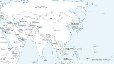
The Arunachal Pradesh map controversy has triggered a fresh political response, with the Arunachal Pradesh Congress objecting to the way the state has been depicted in a newly issued United Nations world map.
The party has maintained that Arunachal Pradesh’s status as an Indian state is non-negotiable. Its objection comes as New Delhi has also raised concerns over what it describes as anomalies in the UN map and reiterated that India’s territorial position remains unchanged.
The issue has gained attention after the map showed Arunachal Pradesh and Aksai Chin between Indian and Chinese lines, prompting questions over how disputed boundaries are represented in international cartography.
What the UN map shows
The Arunachal Pradesh map under discussion was published by UN Geospatial on July 1, 2026. It uses the Equal Earth projection, which is designed to show the relative size of continents more accurately.
However, its treatment of the India-China border has attracted scrutiny. Reports say the map depicts Arunachal Pradesh between separate Indian and Chinese lines. It also does not show the state’s boundary with Nagaland in the same way as India’s official maps.
The depiction has become controversial because India administers Arunachal Pradesh as a full state and considers it an integral part of the country. China, meanwhile, continues to claim the state and refers to it as “Zangnan” or South Tibet.
India rejects any misleading depiction
The Arunachal Pradesh map controversy surfaced shortly after India supported a UN General Assembly resolution on improving the accuracy of world maps.
The resolution, adopted on September 4, focuses on equal-area cartographic representation. India supported that principle but made clear that its vote should not be viewed as approval of any particular map or territorial depiction.
External Affairs Ministry spokesperson Randhir Jaiswal said India had taken up the anomalies with the concerned persons. He also stressed that India’s sovereign territory must be represented according to the country’s official map.
Moreover, New Delhi said any inaccurate or misleading representation of its territory is unacceptable. The government has described its position on sovereignty and territorial integrity as clear and non-negotiable.
Why the Arunachal Pradesh map matters
Maps are not only geographical tools in a sensitive border dispute. They can also influence how territories are understood by international organisations, institutions and the wider public.
For the Congress in Arunachal Pradesh, the issue therefore carries political and territorial significance. The party’s objection reflects a broader demand that the state’s constitutional and administrative status should not be presented in a manner that creates ambiguity.
At the same time, the UN map does not by itself change the legal or administrative status of Arunachal Pradesh. The controversy is instead about representation and the message conveyed by an internationally circulated map.
UN resolution and border sensitivities
The Arunachal Pradesh map row also highlights the difficulty of separating cartographic reforms from long-running territorial disputes.
The “Correct the Map” initiative was primarily linked to concerns over the distortion of continental sizes under traditional map projections. India supported the effort because of its focus on more equitable representation.
However, the use of the new mapping material has brought India’s border concerns into the discussion. A UN General Assembly resolution does not settle territorial disputes, nor does it automatically establish sovereignty over contested areas.
Meanwhile, India and China continue to manage their wider boundary dispute through diplomatic and military channels. Recent corps commander-level talks in Arunachal Pradesh have also underlined the continuing importance of stability along the Line of Actual Control.
Arunachal status remains a firm political issue
The Arunachal Pradesh map controversy is likely to remain politically sensitive because the state occupies a central position in India’s eastern border strategy.
For the Congress, the objection reinforces its position that Arunachal Pradesh’s status cannot be diluted through inaccurate or ambiguous representations. For the Centre, the latest controversy has provided another opportunity to restate India’s official position on territorial integrity.
Overall, the dispute is less about changing facts on the ground and more about how those facts are presented internationally. As India continues to engage with the UN over the disputed depiction, the focus will remain on ensuring that maps used by international institutions do not create an impression that conflicts with New Delhi’s official territorial position.
Bhupen Hazarika now inspires Assam as centenary tributes grow