




A new collaborative initiative is strengthening soil health monitoring across Northeast India. The North Eastern Council (NEC)-sponsored programme brings scientists, administrators and farmers together to improve soil assessment. IIT Guwahati hosted its launch workshop on March 27, 2026. The event introduced practical tools for measuring soil organic carbon. It also provided farmers with training in field assessment and geospatial applications. Meanwhile, a separate scientific atlas released in April mapped sulphur and micronutrient conditions across all eight Northeastern states. Together, these efforts offer valuable information for better agricultural planning and sustainable soil management.
Gauhati High Court Quashes Pranab Doley’s NSA Detention
IIT Guwahati Leads Regional Soil Monitoring Initiative
The School of Agro and Rural Technology at IIT Guwahati hosted a one-day training and capacity-building workshop on March 27, 2026. The event marked the launch of a collaborative effort to strengthen soil health management across the Northeast.
The North Eastern Council sponsors the initiative. Furthermore, ICAR-ATARI Zones VI and VII and Krishi Vigyan Kendras across the region support its implementation.
The programme aims to make scientific soil assessment more accessible to farmers. It focuses particularly on soil organic carbon, an important indicator of soil quality.
The workshop brought together government officials, agricultural scientists and farmers. Dr Ravi Kota, Chief Secretary of Assam, attended as the chief guest. IIT Guwahati Director Professor Devendra Jalihal also participated.
Professor Sudip Mitra, Head of the School of Agro and Rural Technology, serves as the project’s principal investigator. His team is coordinating the academic and scientific work.
Soil Carbon Kits Bring Testing Closer to Farmers
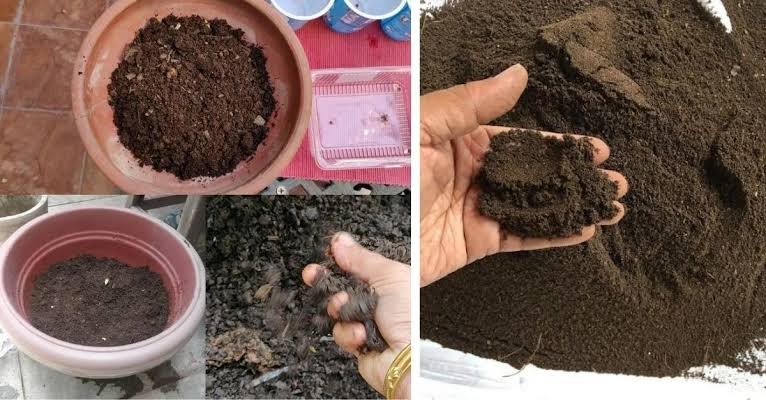
A major feature of the initiative involves distributing Soil Carbon Kits to participating farmers. These field tools help users measure and monitor soil organic carbon.
During the workshop, Dr Ravi Kota distributed the kits to farmers. He encouraged participants to collect soil data carefully and systematically.
However, accurate assessment requires proper guidance. Therefore, scientists from Krishi Vigyan Kendras will support farmers during field-level activities.
The workshop also included practical training sessions. Participants learned about soil assessment techniques and geographic information system applications.
This approach can help farmers understand variations in soil conditions. It may also support better decisions about soil management and crop production.
Moreover, field-based testing can strengthen the connection between agricultural research and farming communities. Farmers can contribute local observations while scientists provide technical guidance.
Northeast Soil Atlas Maps Nutrient Conditions
A separate scientific development has added another important resource for regional agriculture. Researchers released the Atlas of Sulphur and Micronutrient Status in Soils of Northeast India on April 18, 2026.
The publication was launched during the XXX Biennial Workshop of the All India Coordinated Research Project on Micro and Secondary Nutrients in Soils and Plants. The event took place at ICAR-Indian Institute of Soil Science in Bhopal.
The AICRP-MSPE Imphal Centre at Central Agricultural University produced the atlas. Professor Indira Sarangthem led the editorial work with 11 co-editors.
The atlas provides soil fertility maps covering sulphur and five essential micronutrients. These include zinc, iron, copper, manganese and boron.
Importantly, the publication covers all eight Northeastern states. These are Assam, Arunachal Pradesh, Manipur, Meghalaya, Mizoram, Nagaland, Sikkim and Tripura.
It also presents district-level variations and crop-specific nutrient management options. Consequently, agricultural planners and farmers can use the information to identify nutrient-related challenges.
Why Soil Health Mapping Matters in Hilly Areas
Northeast India has varied landscapes and farming conditions. Mountain slopes, forested areas, valleys and river basins create different soil characteristics.
Therefore, a single fertiliser recommendation may not suit every location. Soil testing helps identify differences in nutrient availability and soil quality.
Hilly terrain also creates practical difficulties for field surveys. Remote settlements, difficult access and limited testing infrastructure can slow down sample collection.
The Union Agriculture Ministry has acknowledged these challenges. In a March 2025 parliamentary response, it highlighted logistical and technical barriers to soil fertility mapping in remote and hilly areas.
The ministry also noted the use of village-level soil testing laboratories and mini laboratories. These facilities can help address testing difficulties in remote locations.
Meanwhile, ICAR-National Bureau of Soil Survey and Land Use Planning has an established regional centre in Jorhat. Its mandate covers soil resource information and land-use planning across the Northeast.
The centre uses remote sensing and geographic information systems for soil surveys. Its work includes soil nutrient mapping and land evaluation.
Digital Mapping Can Support Better Crop Planning
Digital soil information can help farmers make more informed agricultural decisions. It allows scientists to combine field samples, laboratory results and geographical data.
The government already uses geospatial methods to prepare digital soil fertility maps. The Soil and Land Use Survey of India generates district and village-level maps using Soil Health Card data.
These assessments examine several soil properties. They include pH, electrical conductivity, organic carbon, nitrogen, phosphorus, potassium, sulphur and micronutrients.
Furthermore, geospatial information can help identify areas with nutrient deficiencies or surpluses. Farmers can then receive more location-specific fertiliser recommendations.
The National Soil Mapping Programme also aims to build a detailed digital soil resource database. Its guidelines describe village-level mapping at a 1:10,000 scale.
The programme combines field surveys, soil profiles, remote sensing and GIS techniques. It aims to support crop planning and sustainable land use.
However, the available records do not confirm a newly launched, separate digital mapping project covering every Northeastern hill district. The regional initiatives instead represent complementary efforts in soil-carbon monitoring, nutrient mapping and soil resource assessment.
Stronger Scientific Support for Regional Farmers
The new initiatives could improve agricultural planning across the Northeast. Soil information can help farmers understand the condition of their land before selecting crops or applying nutrients.
For example, nutrient maps can highlight areas that need specific soil amendments. Similarly, organic carbon measurements can help track changes in soil quality.
This information may support more balanced fertiliser use. It can also reduce unnecessary input costs when farmers follow suitable recommendations.
Additionally, scientific data can assist state agriculture departments. Officials can use local soil information to identify priority areas for extension services and infrastructure.
Krishi Vigyan Kendras will remain important to this process. Their field-level support can help farmers use testing tools and understand the results.
At the same time, continued research will improve the reliability of soil information. Regular sampling and updated databases will be essential.
Conclusion
Northeast India is strengthening soil health assessment through regional research and farmer-focused training. The NEC-sponsored IIT Guwahati initiative promotes soil-carbon monitoring through field kits and scientific guidance. Meanwhile, the new soil atlas provides district-level information on sulphur and micronutrients across all eight states. These efforts can support more precise crop planning and better nutrient management. Continued investment in laboratories, field surveys and digital databases will determine their long-term impact on regional agriculture.
FAQs
1. Which institution launched the Northeast soil monitoring initiative?
IIT Guwahati’s School of Agro and Rural Technology hosted the launch workshop on March 27, 2026.
2. Who sponsors the soil-carbon monitoring initiative?
The North Eastern Council sponsors the programme, with support from ICAR-ATARI Zones VI and VII and regional KVKs.
3. What are Soil Carbon Kits used for?
They help farmers measure and monitor soil organic carbon through field-level assessment.
4. Which states does the new soil atlas cover?
It covers Arunachal Pradesh, Assam, Manipur, Meghalaya, Mizoram, Nagaland, Sikkim and Tripura.
5. Which nutrients does the atlas examine?
It maps sulphur, zinc, iron, copper, manganese and boron in regional soils.
6. How can soil mapping help farmers?
It can identify nutrient deficiencies and support location-specific fertiliser recommendations and crop planning.