





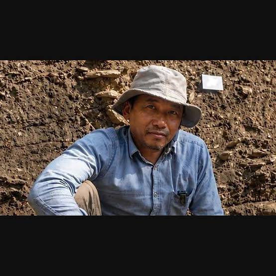
Anthropologist Tiatoshi Jamir has highlighted the significant archaeological potential of Northeast India, arguing that the region contains a far denser record of prehistoric human activity than existing maps and surveys have captured. The observation could encourage wider archaeological exploration across a region whose complex terrain has historically made systematic research challenging.
The assessment places greater attention on prehistoric sites that may remain undocumented or under-researched. Moreover, expanding archaeological surveys could help researchers identify additional rock shelters, caves, habitation areas, tools, and other traces of early human activity.
The findings also raise broader questions about how researchers understand prehistoric movement across Northeast India and its connections with neighbouring parts of Asia. However, estimates about the density of archaeological sites require systematic fieldwork, dating, documentation, and independent verification.
Equal Development Policy: Kipgen Announces Balanced Funding
Northeast India Emerges as an Archaeological Frontier
Northeast India occupies an important position within the broader Asian landscape.
The region connects the Indian subcontinent with areas of Southeast Asia and contains diverse mountains, valleys, forests, river systems, and caves. Furthermore, these environments could have provided different resources and movement routes for prehistoric communities.
Jamir’s assessment draws attention to the possibility that many archaeological traces remain undiscovered.
However, difficult terrain and dense vegetation can make systematic archaeological surveys particularly demanding.
Prehistoric Footprints May Be More Extensive
Existing archaeological maps may represent only a portion of the region’s prehistoric record.
Researchers can discover archaeological evidence through systematic surveys, excavations, remote sensing, geological studies, and analysis of previously collected materials. Additionally, new research methods can reveal features that earlier investigations could not easily detect.
This creates opportunities to expand the known archaeological record.
However, researchers must distinguish confirmed archaeological sites from areas that merely show potential.
Terrain Has Limited Earlier Surveys
Northeast India’s geography presents significant challenges for field researchers.
Dense forests, steep hills, caves, rivers, and remote settlements can restrict access to potential archaeological locations. Moreover, seasonal weather conditions can make some areas difficult to reach for extended periods.
These challenges can leave substantial gaps in archaeological mapping.
However, advances in remote sensing, geographic information systems, and field technology can help researchers identify promising areas for further investigation.
Caves and Rock Shelters Offer Clues
Natural shelters can preserve evidence of prehistoric human activity.
Rock shelters and caves may contain stone tools, charcoal, animal remains, sediments, and other traces of occupation. Furthermore, layered deposits can reveal repeated use of the same location across different periods.
Recent research interest in Northeast India’s cave systems reinforces the importance of these environments.
However, researchers must carefully document the position and condition of every discovery to establish its archaeological significance.
LiDAR Could Expand Site Discovery
Remote-sensing technologies can help researchers survey difficult landscapes.
Airborne LiDAR, for example, can produce detailed terrain models beneath gaps in dense vegetation. Additionally, satellite imagery and geographic information systems can help researchers identify unusual landscape patterns that deserve field investigation.
These tools can make large-scale surveys more efficient.
However, remote-sensing results require ground verification before researchers can classify suspected features as archaeological sites.
Northeast India Connects Wider Regions
The region’s location gives its prehistoric record wider significance.
Researchers can compare archaeological evidence from Northeast India with material from South Asia and Southeast Asia. Moreover, similarities and differences in stone tools, settlement patterns, and other material remains can help researchers investigate ancient interactions.
This could improve understanding of prehistoric movement across the region.
However, archaeological similarities alone cannot establish direct migration or cultural contact.
Human Mobility Remains a Key Question
Prehistoric populations did not necessarily remain in one location.
Communities could move in response to environmental conditions, resource availability, seasonal patterns, or social factors. Furthermore, different groups could use the same landscape at different times.
A denser archaeological record could help researchers investigate these patterns.
However, establishing mobility requires evidence from multiple sites and reliable chronological information.
Archaeological Maps Could Change
The claim of a denser prehistoric record could encourage researchers to revisit existing archaeological maps.
New surveys may identify previously undocumented sites and refine the locations of known ones. Additionally, improved dating could reveal that some regions contain longer sequences of human activity than researchers previously recognised.
This could substantially expand the regional archaeological database.
However, researchers should update archaeological maps through transparent evidence and standard documentation practices.
Interdisciplinary Research Can Strengthen Findings
Understanding Northeast India’s prehistoric past requires multiple scientific approaches.
Archaeologists can study artefacts and settlement patterns, while geologists can analyse sediments and landscapes. Furthermore, palaeoenvironmental specialists can reconstruct past climates and ecosystems, while genetic researchers may examine ancient population relationships when suitable evidence exists.
Combining these disciplines can produce stronger conclusions.
However, each field has different methods and limitations that researchers must account for.
Dating Determines Historical Significance
Finding an artefact does not automatically reveal its age.
Researchers need chronological evidence to determine when people occupied a particular site. Moreover, accurate dating allows scientists to compare archaeological discoveries from different regions and establish patterns of technological or cultural change.
This makes chronological research essential to expanding the prehistoric record.
However, dating results can carry uncertainties and require careful interpretation.
Local Knowledge Can Guide Surveys
Communities across Northeast India can contribute valuable information during archaeological exploration.
Residents may know about caves, rock shelters, unusual stone features, old pathways, and other locations that researchers have not documented formally. Furthermore, local participation can help researchers access difficult terrain and understand the historical use of landscapes.
This can make archaeological surveys more effective.
However, researchers should respect local communities and follow appropriate permissions and heritage regulations.
Heritage Protection Will Become More Important
As researchers identify additional archaeological sites, protecting them becomes increasingly important.
Uncontrolled construction, erosion, illegal excavation, and other disturbances can damage archaeological deposits. Moreover, once a site loses its original context, researchers may lose important information about how people used the location.
Early documentation can therefore support heritage protection.
However, increased public interest should not expose sensitive sites to unnecessary disturbance.
Education Could Benefit
A richer archaeological record could improve public understanding of Northeast India’s ancient history.
Museums, schools, universities, and cultural institutions could use new discoveries to explain the region’s prehistoric development. Additionally, updated research could encourage students to explore archaeology, anthropology, geology, and related scientific disciplines.
This can strengthen interest in regional heritage.
However, educational materials should reflect evidence-based scholarship rather than presenting preliminary discoveries as established facts.
Research Could Encourage New Expeditions
The assessment could motivate universities and research institutions to conduct additional fieldwork.
Researchers may prioritise areas with limited archaeological coverage and combine traditional excavation with modern mapping technologies. Furthermore, targeted surveys can help determine whether suspected archaeological concentrations represent genuine patterns.
This could gradually expand knowledge of the region.
However, sustained research requires funding, trained specialists, equipment, conservation facilities, and long-term planning.
What Happens Next?
The next step involves systematic verification of areas identified as having archaeological potential.
Researchers can combine field surveys, remote sensing, geological analysis, excavation, and dating to establish the nature and age of suspected sites. Moreover, results from different locations can help create a more complete prehistoric map of Northeast India.
This process could reveal archaeological patterns that earlier surveys missed.
However, researchers should publish detailed evidence and maintain transparent methodologies as the archaeological record expands.
Conclusion
Anthropologist Tiatoshi Jamir’s assessment draws attention to the possibility that Northeast India contains a substantially denser prehistoric archaeological record than existing surveys have documented. The region’s caves, rock shelters, forests, valleys, and mountain landscapes provide numerous environments where traces of early human activity could survive.
Moreover, technologies such as LiDAR, satellite mapping, GIS, and improved dating methods can help researchers explore areas that previous surveys could not easily reach. At the same time, systematic field verification, community engagement, scientific documentation, and heritage protection will remain essential.
Overall, the prospect of a much richer prehistoric record could place Northeast India at the centre of wider archaeological research into early human settlement and movement across South and Southeast Asia.
FAQs
1. Who highlighted Northeast India’s archaeological potential?
Anthropologist Tiatoshi Jamir highlighted the possibility that Northeast India contains a much denser prehistoric archaeological record than existing maps indicate.
2. Why might the region contain undocumented prehistoric sites?
Dense forests, difficult terrain, caves, remote locations, and limited systematic surveys may have left parts of the region under-researched.
3. How can modern technology help archaeologists?
LiDAR, satellite imagery, GIS, digital mapping, and other technologies can help researchers identify promising landscapes and plan targeted field investigations.
4. Why is Northeast India important for prehistoric research?
Its geographic position between the Indian subcontinent and Southeast Asia makes the region particularly relevant to research into prehistoric settlement and human movement.
5. Will new discoveries immediately rewrite prehistoric history?
No. Researchers must verify archaeological evidence through excavation, dating, analysis, and peer-reviewed research before drawing broader historical conclusions.