




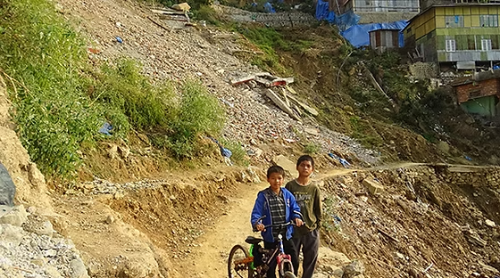
The Aizawl Sinking Zone came under scientific assessment as geological experts surveyed active ground sinking areas in Aizawl’s Hunthar quarter. The survey aims to evaluate land stability, gather geological data, and support future planning for infrastructure development and disaster risk management in the affected locality.
NH-717A Blocked After Major Landslide Cuts Off Traffic at Pakyong
The Aizawl Sinking Zone has received renewed attention after geological experts conducted a detailed survey of active sinking areas in the Hunthar quarter. According to the available information, the assessment focused on studying ground conditions to better understand land movement and its potential implications for the area.
Ground subsidence and land instability present important challenges in hilly regions where geological conditions and environmental factors can influence terrain stability. Moreover, scientific surveys provide valuable information that helps authorities understand changing ground conditions and plan appropriate mitigation measures.
The latest survey reflects continued efforts to strengthen geological monitoring in vulnerable urban locations. Therefore, the study is expected to support informed decision-making regarding infrastructure planning and public safety.
The initiative also demonstrates the importance of evidence-based assessments in managing geologically sensitive areas. Additionally, expert surveys contribute to a better understanding of local terrain conditions and long-term urban resilience.
Aizawl Sinking Zone Survey Focuses on Ground Stability
The Aizawl Sinking Zone survey concentrated on evaluating active sinking areas within the Hunthar quarter. Geological experts typically examine soil conditions, terrain characteristics, and visible signs of ground movement to assess land stability.
Moreover, scientific field surveys help authorities collect reliable information for future planning and risk assessment. Consequently, regular geological monitoring contributes to more effective management of areas susceptible to land instability.
Urban geological studies remain an important part of infrastructure planning, particularly in mountainous regions. Furthermore, monitoring ground conditions helps planners identify areas that may require additional attention during future development.
The available information confirms that geological experts surveyed active sinking zones in Hunthar. However, authorities have not released details regarding the survey findings, the extent of the affected area, or any recommendations arising from the assessment.
Scientific Assessment Strengthens the Aizawl Sinking Zone Study
The Aizawl Sinking Zone assessment highlights the important role of geological research in supporting safe urban development. Scientific surveys provide technical data that can assist engineers, planners, and policymakers in evaluating land conditions before future projects are undertaken.
Additionally, continuous geological monitoring improves understanding of terrain behavior over time. This approach supports informed infrastructure planning while encouraging evidence-based decision-making.
The latest survey reflects ongoing efforts to evaluate geologically sensitive locations within Aizawl. Meanwhile, expert assessments continue to serve as an important resource for understanding land stability in urban environments.
The available information does not indicate whether any structural damage, evacuation measures, or engineering interventions have been recommended. Therefore, the current update relates specifically to the geological survey conducted in the Hunthar quarter.
The initiative represents another step toward strengthening scientific knowledge of local geological conditions.
Aizawl Sinking Zone Survey Supports Safer Urban Planning
The Aizawl Sinking Zone study carries broader significance for disaster preparedness and sustainable urban development in Mizoram. Geological investigations provide essential information that supports responsible land-use planning and infrastructure management in areas affected by ground instability.
Moreover, improved understanding of geological conditions can help authorities make informed decisions regarding future development and public infrastructure. Scientific research also contributes to strengthening long-term resilience in urban communities.
The survey in Hunthar demonstrates the importance of expert evaluation in managing geologically sensitive locations. Similarly, regular monitoring supports proactive planning and helps improve preparedness for potential environmental challenges.
Maintaining comprehensive geological assessments remains an important priority for sustainable urban growth. Consequently, the Aizawl Sinking Zone survey represents a positive step toward enhancing scientific knowledge, improving planning practices, and supporting safer infrastructure development.
As the assessment process continues, future official updates are expected to provide additional information regarding survey findings and any recommended follow-up measures.
Conclusion
The Aizawl Sinking Zone survey has brought geological experts to the Hunthar quarter to assess active ground sinking areas and gather scientific data on land stability. The initiative reflects continued efforts to improve understanding of geological conditions and support informed urban planning.
Furthermore, expert assessments contribute valuable information for infrastructure planning, disaster preparedness, and sustainable development in geologically sensitive areas. The survey also highlights the importance of ongoing monitoring in maintaining public safety.
Overall, the Aizawl Sinking Zone study marks an important step toward strengthening geological research and improving long-term urban resilience in Aizawl. As authorities review the survey findings, future updates are expected to provide greater insight into ground conditions and any subsequent planning measures.
FAQs
1. What is the latest update on the Aizawl Sinking Zone?
The Aizawl Sinking Zone has been surveyed by geological experts to assess active ground sinking areas in the Hunthar quarter.
2. Where was the geological survey conducted?
According to the available information, the survey was carried out in Hunthar quarter of Aizawl.
3. What was the purpose of the survey?
The assessment aimed to study ground stability, collect geological data, and support future planning and risk management.
4. Have the survey findings been released?
No. The available information confirms that the survey was conducted but does not include the results or recommendations.
5. Did authorities announce any safety measures following the survey?
No. The available information does not mention any specific safety measures, engineering works, or evacuation plans.