





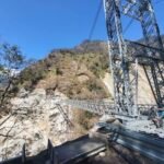

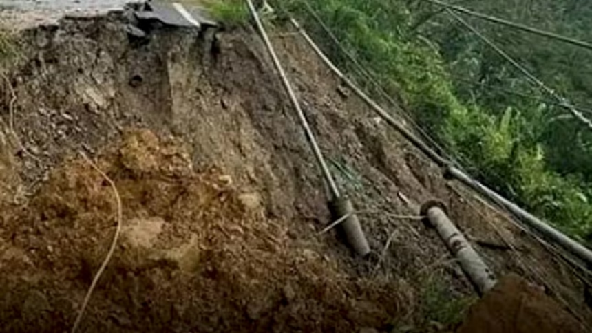
The Sikkim Mangan Landslide Impact has raised concerns after a massive landslide struck Mangan district during the intervening night of September 5 and 6, partially obstructing the flow of the Teesta and Chyakoong rivers. The incident occurred near their confluence in North Sikkim. Moreover, authorities monitored the situation closely after debris entered the river channels. No deaths or injuries were reported in the initial assessments.
Vigilance Awareness Programme Tripura Begins Under Probity for Prosperity Campaign
Sikkim Mangan Landslide Impact Disrupts River Flow
The Sikkim Mangan Landslide Impact became significant after a large section of hillside collapsed near the Chyakoong River in Mangan district.
According to reports, the landslide occurred during the night of September 5 and 6. Debris entered the channels of the Teesta and Chyakoong rivers near their confluence.
Moreover, the obstruction temporarily affected the normal movement of water through the river system.
The incident prompted authorities to monitor water levels and assess possible downstream risks.
Meanwhile, reports indicated that the Teesta later returned to normal flow conditions, while monitoring stations recorded normal water levels.
However, authorities remained cautious because accumulated water behind or around a landslide blockage can create additional risks if conditions change.
Therefore, downstream areas received precautionary attention as officials assessed the situation.
The incident also highlighted the vulnerability of mountainous areas in Sikkim to landslides, particularly during the monsoon period.
Furthermore, steep terrain and heavy rainfall can increase the likelihood of slope instability across Himalayan regions.
Chyakoong and Teesta Rivers Face Temporary Obstruction
The Sikkim Mangan Landslide Impact also drew attention to the relationship between landslide activity and river systems in mountainous terrain.
The landslide occurred above the Chyakoong River and affected the area near its meeting point with the Teesta.
Consequently, a substantial amount of debris entered the river channels and temporarily obstructed water flow.
Additionally, reports said water accumulated in the affected river sections, prompting authorities to remain alert to potential downstream consequences.
The situation required careful monitoring because sudden changes in a temporary river obstruction can affect downstream water levels.
Moreover, authorities need accurate information about river conditions before determining whether additional precautionary measures are necessary.
Meanwhile, the Teesta remains one of Sikkim’s major river systems and plays an important role in the region’s geography and infrastructure.
Therefore, disruptions along its course can attract significant administrative attention.
The latest incident also demonstrated the importance of monitoring vulnerable slopes and river corridors during periods of heavy rainfall.
However, the reported temporary obstruction did not result in casualties in the initial assessment.
Authorities consequently focused on monitoring the river system and surrounding areas.
Mangan District Remains Vulnerable to Landslides
The Sikkim Mangan Landslide Impact has once again highlighted the geological and environmental challenges facing Mangan district.
Mangan forms part of the mountainous landscape of North Sikkim, where steep slopes and narrow river valleys create natural vulnerability to landslides.
Moreover, the monsoon season can increase pressure on unstable slopes because prolonged or intense rainfall can saturate soil and weaken sections of terrain.
Therefore, authorities regularly need to monitor areas where roads, rivers and settlements lie close to steep hillsides.
The latest landslide reportedly affected an area near the newly cut Naga-Tosa Road and the Theng Tunnel.
Additionally, the incident shows how slope failures can affect more than roads alone.
When debris reaches river channels, it can temporarily alter water movement and create additional concerns for downstream locations.
Meanwhile, infrastructure agencies and district authorities need to maintain awareness of such risks while managing transportation and connectivity in mountainous areas.
Furthermore, early information about landslides can help authorities assess whether nearby communities or infrastructure require additional precautions.
The incident therefore reinforces the importance of disaster preparedness across Sikkim’s vulnerable mountain corridors.
Sikkim Mangan Landslide Impact Raises Preparedness Concerns
The Sikkim Mangan Landslide Impact could strengthen attention toward landslide monitoring and disaster preparedness in the state.
Mountainous regions require continuous observation because natural hazards can develop rapidly, particularly during periods of intense rainfall.
Moreover, monitoring river levels can help authorities identify changes following slope failures.
Early warnings can also help officials communicate potential risks to people living or travelling downstream.
Additionally, coordination between district administration, disaster management agencies and infrastructure authorities can improve emergency preparedness.
Meanwhile, authorities must assess both immediate conditions and possible secondary risks after a major landslide.
A temporary blockage may change river behaviour, while further slope movement could potentially introduce additional debris into affected channels.
Therefore, continued observation remains important even after river flow begins to normalise.
The incident also highlights the value of resilient infrastructure in regions where roads, tunnels and bridges operate in challenging terrain.
Furthermore, scientific monitoring, rainfall data and geological assessments can support better understanding of vulnerable locations.
However, the latest event also demonstrates that not every landslide results in major casualties or prolonged disruption.
In this case, initial reports indicated no deaths or injuries, while authorities continued monitoring the affected rivers.
Consequently, the incident underscores the importance of preparedness, timely information and coordinated response.
Conclusion
The Sikkim Mangan Landslide Impact has highlighted the continuing landslide and river-management challenges facing mountainous areas of Sikkim. The September 5–6 incident partially obstructed the Teesta and Chyakoong rivers near their confluence in Mangan district. Moreover, authorities monitored the situation because of possible downstream risks, while initial reports indicated no deaths or injuries. Continued surveillance of vulnerable slopes, river levels and infrastructure will remain important as the monsoon season continues.
FAQs
1. What caused the Sikkim Mangan Landslide Impact?
A major landslide struck Mangan district during the intervening night of September 5 and 6, with debris entering the Chyakoong and Teesta river channels.
2. Which rivers did the landslide affect?
The landslide partially obstructed the Chyakoong and Teesta rivers near their confluence in Mangan district.
3. Were there any casualties?
Initial reports indicated that no deaths or injuries occurred in the incident.
4. Why did authorities monitor downstream areas?
Authorities monitored downstream areas because water accumulated around the temporary river obstruction, creating a need to watch for possible changes in water levels.
5. Why is Mangan vulnerable to landslides?
Mangan lies in Sikkim’s mountainous Himalayan terrain, where steep slopes, heavy rainfall and narrow river valleys can contribute to landslide risks.

